Bringing people together, exchanging information, building a network. Those were what we set out to do. In this series of products – a report, a website and a conference – we made it easy to communicate the largest scale open space network we had worked with to date.
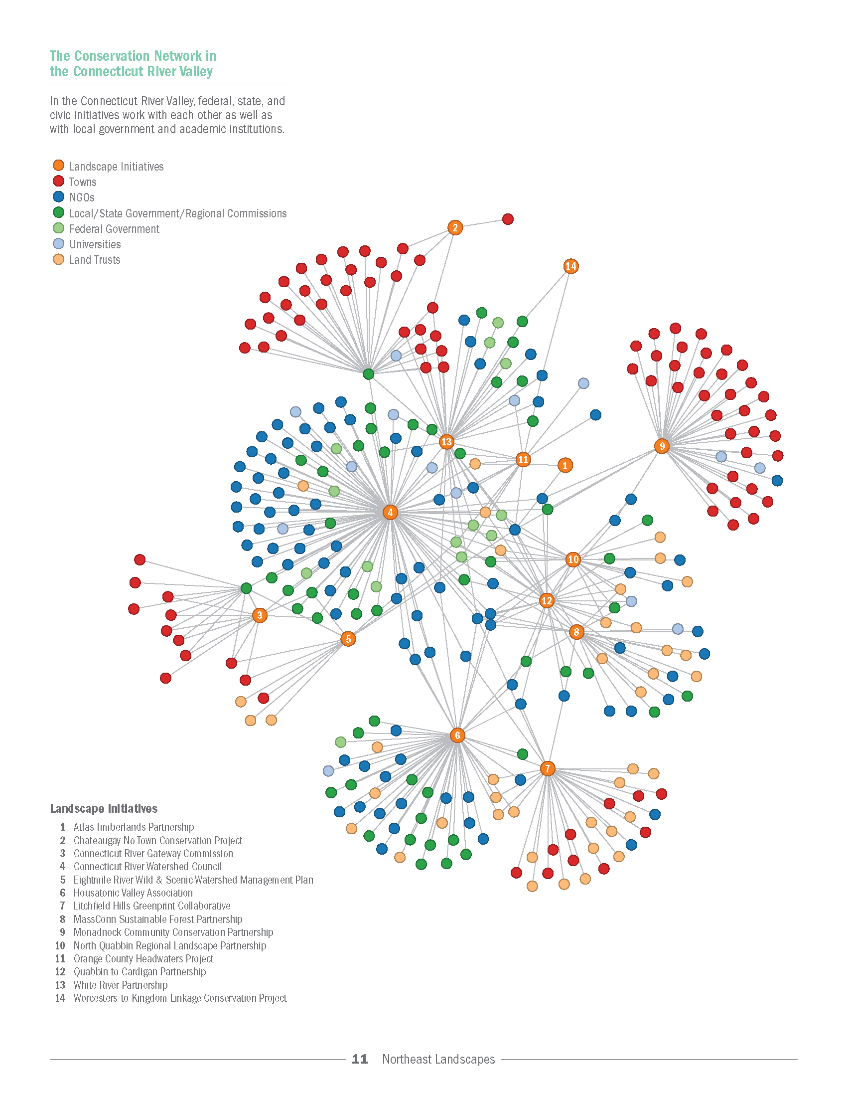
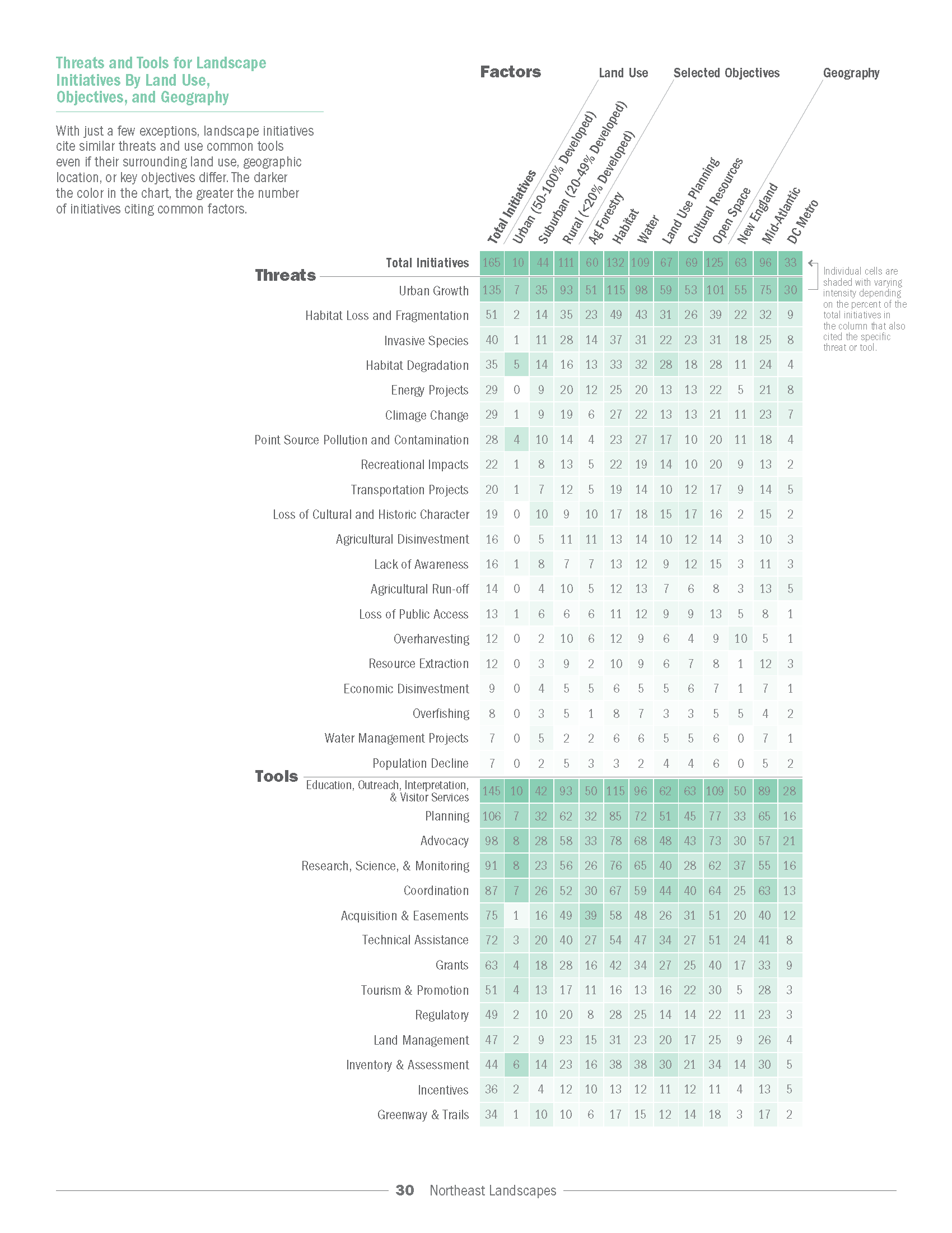
The gathering of data, the crowdsourcing of the accuracy, the heavy information design all ended in an atlas and experience that brought everyone together in Manhattan to find out what each other was doing. We took this massive amount of data and made it usable, clear and beautiful through new tools – using Processing and D3 for the charts and network diagrams & GIS in Illustrator for the maps.
Also to be credited are the whole Open Space team at Regional Plan Association, plus Ben Oldenburg and Kyle Joseph Kozar for all their hard work.