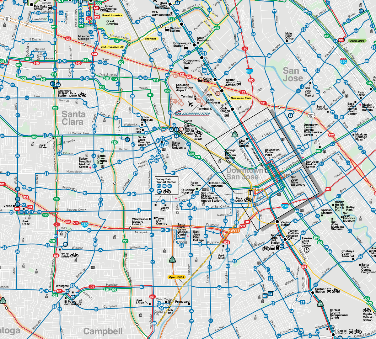
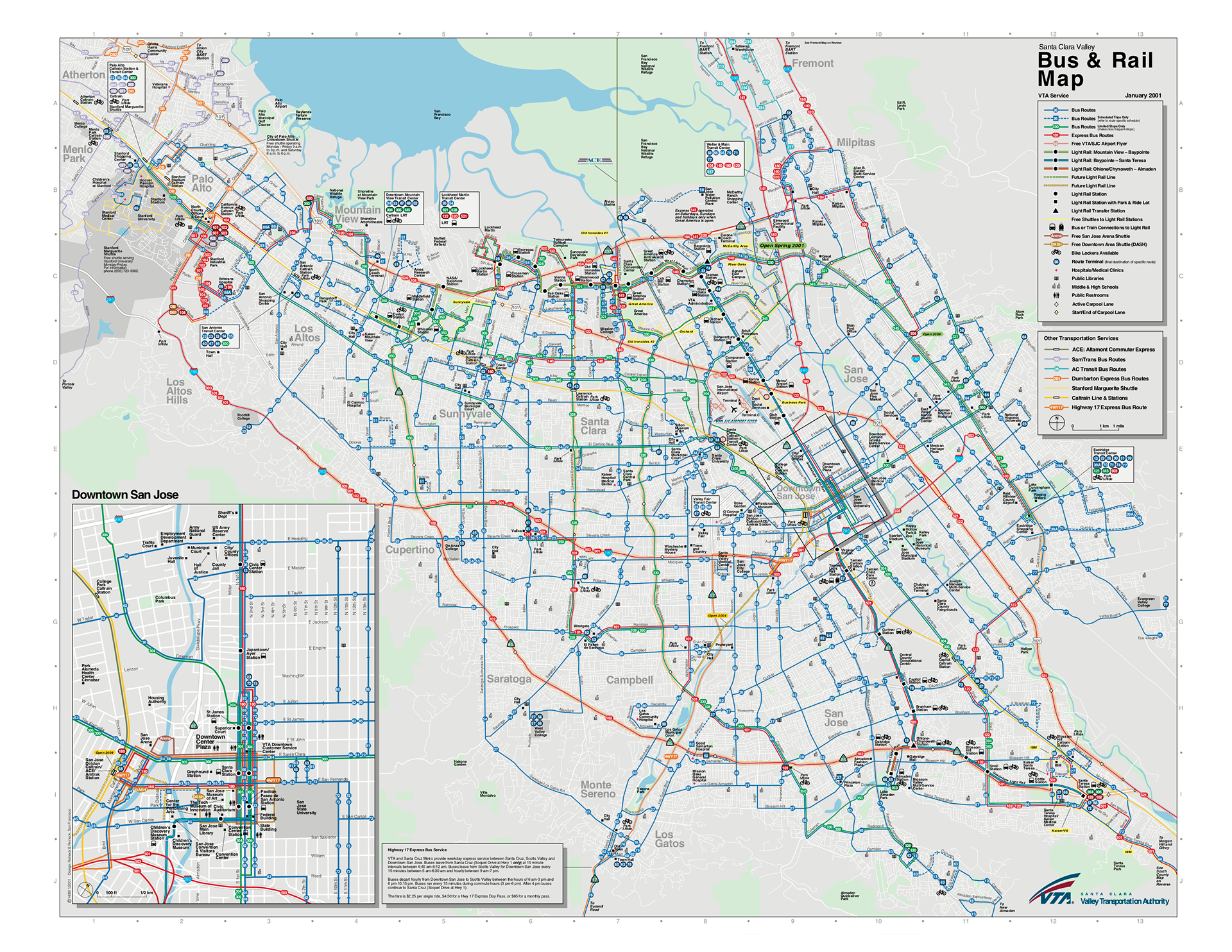
VTA (Santa Clara) System and Route Maps, 2000
A complete rebuild and redesign of the Santa Clara County’s VTA system map. We started – essentially from scratch – with aerials of the county, traced/redrew the roads and features, rethinking every process to make it easier to update in the future. In 2013, after a decade or more, it won “Best Public Transit System in North America” at APTA’s Multimodal Operations Conference.
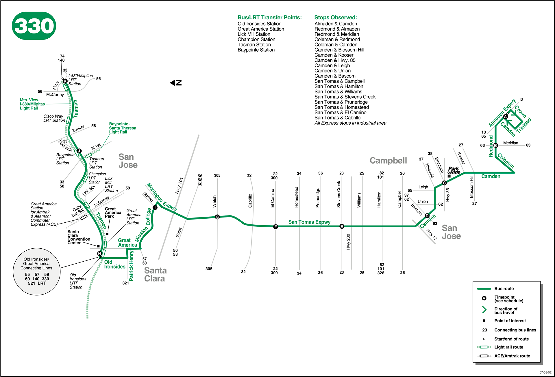
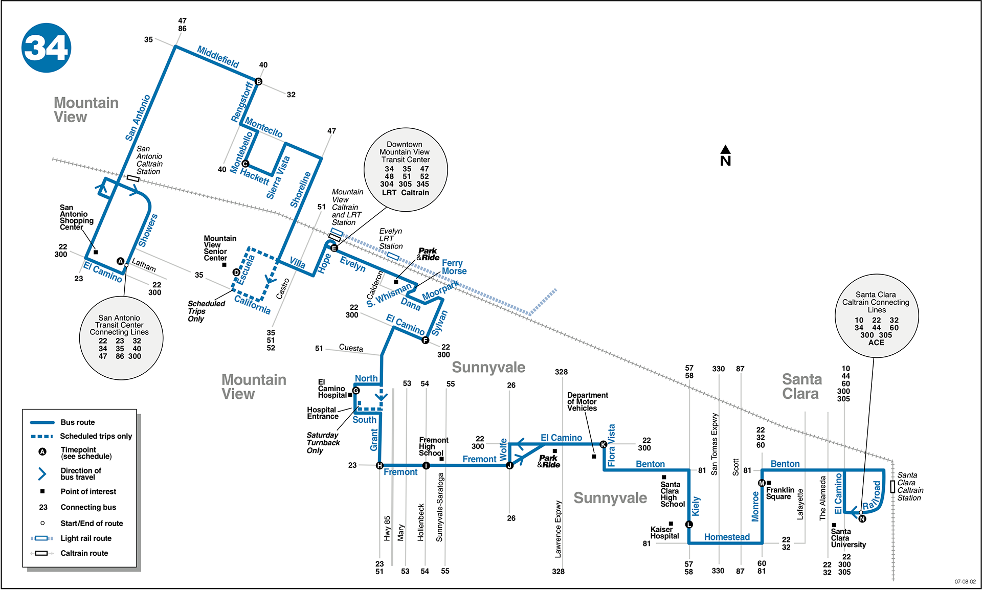
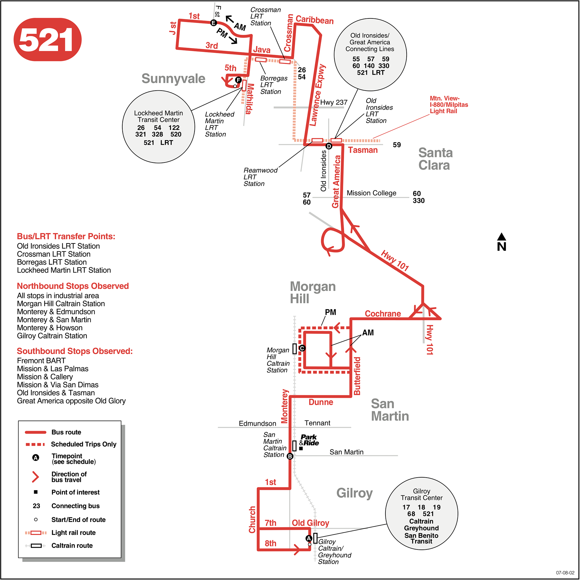
The second part of the project was a new series of printed, folded route maps, found at bus stops and transit hubs. Each hand-held map was intended to represent the functional journey from the beginning to the end of the route.
Credit: Reineck and Reineck, Santa Clara VTA![](https://pro2-bar-s3-cdn-cf3.myportfolio.com/4a52ee679624acec4676e725f924cc35/e6674597-3358-47a3-9839-c76d43cfc892_rw_1200.png?h=ebf1c28f0a42a77df492d702a30af2e2)
![](https://pro2-bar-s3-cdn-cf4.myportfolio.com/4a52ee679624acec4676e725f924cc35/f5a3bcb1-632a-40ec-825f-19bace190f5d_rw_1920.png?h=f185866fc7aba2f07ea5c82e76be6422)
![](https://pro2-bar-s3-cdn-cf1.myportfolio.com/4a52ee679624acec4676e725f924cc35/c67ef099-f7ad-4340-9966-7fbaa4d4594f_rw_1920.png?h=1ef91e7294158e38cb68be6eb1ff7eb3)
![](https://pro2-bar-s3-cdn-cf6.myportfolio.com/4a52ee679624acec4676e725f924cc35/af6188b8-f405-40a3-bee2-a5cb2fa0f19c_rw_1920.png?h=10431d82a7adedd59081a9509326e829)
![](https://pro2-bar-s3-cdn-cf1.myportfolio.com/4a52ee679624acec4676e725f924cc35/9f4f3c8e-3639-4c73-b8d5-54fa609d94d8_rw_1920.png?h=36d3c29552b9a35060206ac58665a48e)